Full city wide SkyTran coverage can reclaim land wasted on roads and parking
(Click thumbnail photo to enlarge)
An aerial view of Los Angeles, California shows how much important land area is consumed for automobile travel. Elimination of the parking lots shown in this picture alone would provide room to erect a dozen additional skyscrapers.
Th
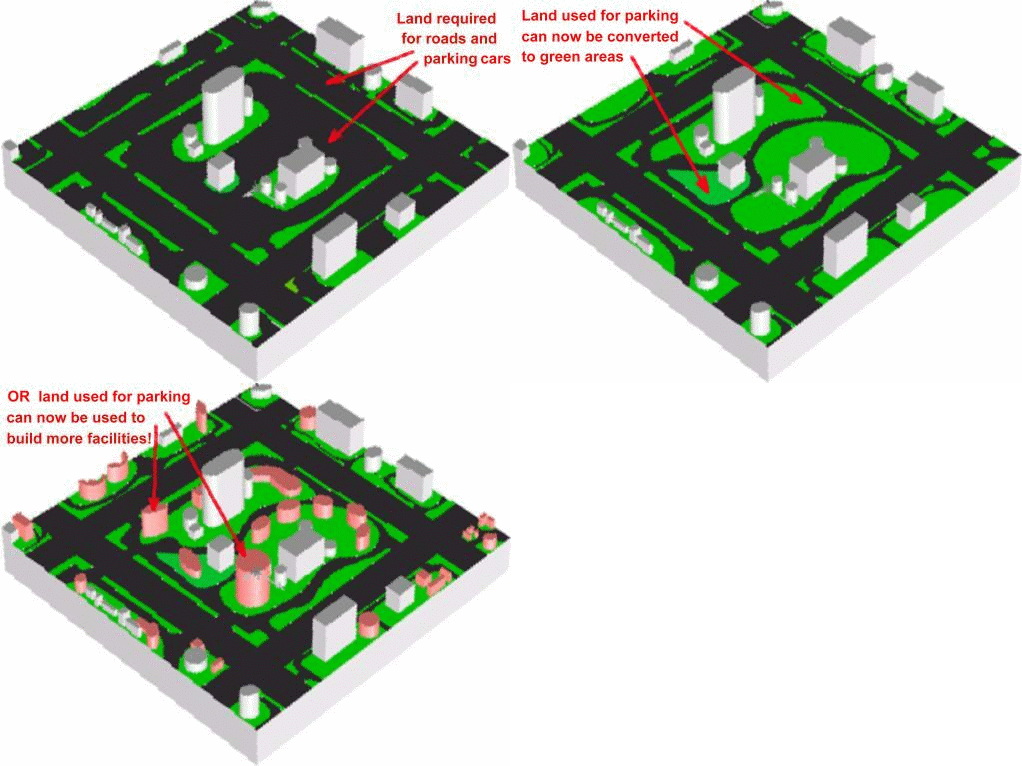
e animation below shows how much land can be freed up for productive uses once a 3D SkyTran networked elevated grid has been fully implemented in any large city. Very few commuters will want to drive to work once they realize they can sit back and relax or do something productive while traveling non-stop at 100 mph to their jobs with zero traffic tension and greatly enhanced safety.Frame 1 shows a typical suburban industrial park setting with a few buildings and the typical paved areas needed to park employees automobiles. At many large facilities 1/2 to 2/3rds of a company’s property is devoted to employee parking.
Frame 2 shows what can happen as SkyTran becomes widely used by the large majority of commuters. All those parking spaces will no longer be required, so why not plant them with greenery?
Frame 3 shows the solution for companies that are desperate for more land to expand their facilities. The land has been there all
along! It was consumed by asphalt to park people's cars. SkyTran implementation will free up this land. What is the value of this freed up land?

Land use sequence drawings
were created by SkyTran team member John Cole using SolidWorks 3D CAD.
![]()